|
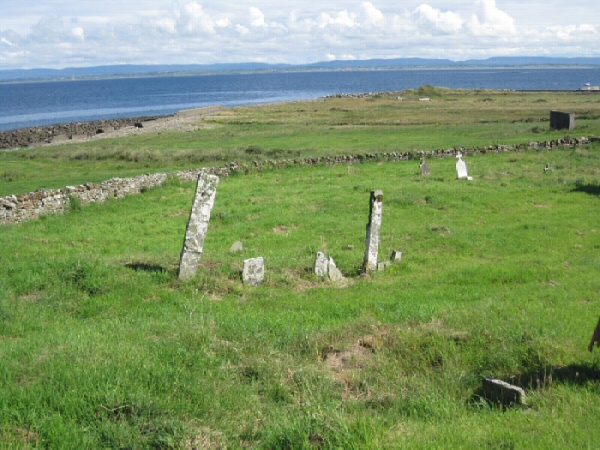
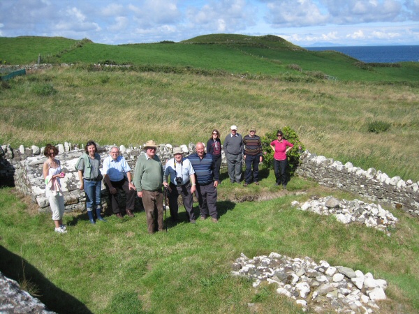
From Castlebar - County Mayo - Mayo Historical and Archaeological Society The members of the Mayo Historical & Archaeological Society who took part in last Sunday's field-trip to North Mayo were blessed with a beautiful day, steeped in sunshine. The group visited several ancient historic and prehistoric monuments on the journey, starting at the Dolmen of the Four Maols on the outskirts of Ballina. The party then moved on to Kilroe church, near Killala, possibly one of the oldest ruined church buildings in the country. The adjacent Moyne Franciscan Friary, with it 90 feet high tower, one of two Franciscan houses in the area, was a most interesting place to see, and the members viewed the ancient ship ‘graffiti' which was incised in the second coat of plaster during the construction of the friary c. 1460. Breastagh Ogham Stone, the Wedge-tomb at Rathfran Park and Rathfran Abbey were next on the itinerary, and a very welcome stop for a picnic lunch followed. The party then moved on to Kilcummin, where the French Expeditionary forces, under the command of Gemeral Humbert, landed on August 22nd, 1798. The 9th-10 century church at Kilcummin from which the area derives its name, stands in a graveyard surrounded by some very interesting monuments i.e - a seventh century sundial, two vaulted graves bearing the Coat of Arms (a chained cat) of the Burke family of Heathfield, Ballycastle. A section to the graveyard, north of the church, is devoid of tombstones and this is the reputed mass burial place of the many people who died in a cholera epidemic in 1730, which devastated the population of a village in the area. The last stop on the tour was Downpatrick Head, a site with majestic cliff scenery, blow holes, and a collection of archaeological remains spanning several millennia, these include ring barrows, the remains of an early church, some collapsed walls of an old fort from whence the headland got the name 'Dun Briste', (broken fort). From more recent times there is an abandoned lookout hut which was used by military observers as they kept a watchful eye on the movement of warships during WW.2.
About 80 metres offshore, there is a sea stack, approximately 50 metres high with the remains of some medieval buildings on top. It seems, according McFirbis, that the land bridge connecting the stack and the mainland collapsed during a storm in 1393, and the marooned inhabitants had to be rescued with the use of ship's ropes. The bright conditions on Sunday afforded the party a wonderful view of much of the Sligo and Donegal mountains and coastline, Knocknarea, Co. Sligo and Slieve Leigue, Co. Donegal were clearly visible.
© Copyright 2011 by Castlebar - County Mayo - |